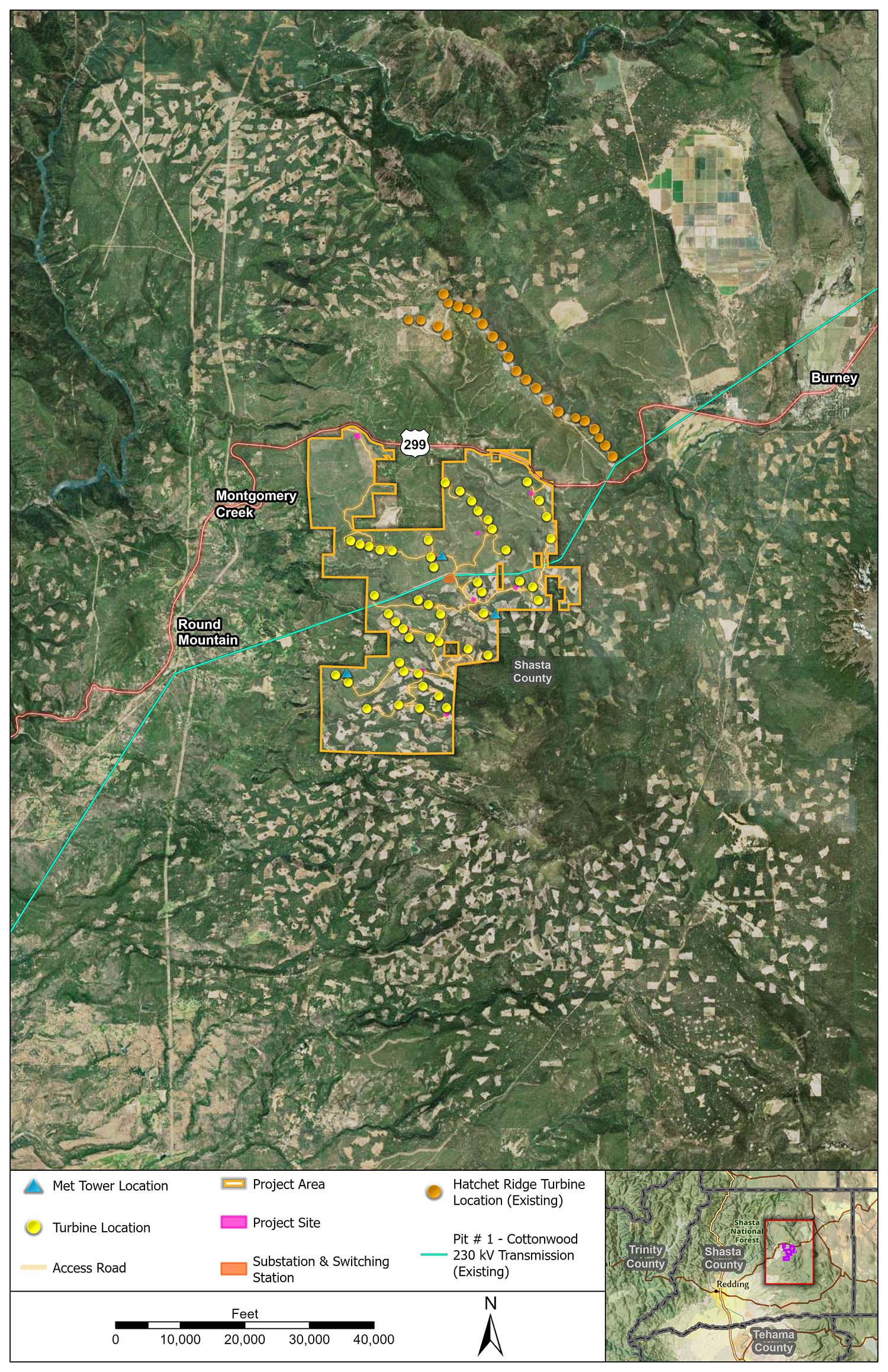
The permanent footprint of the Fountain Wind Project will be up to 475 acres of privately owned timberlands near Highway 299, approximately 6 miles west of Burney and one mile west of the existing Hatchet Ridge Wind Farm.
Approximately 99.7 percent of the project area is zoned as timber production. Wind energy facilities are permitted in timber production zones and use the land compatibly, helping to sustain the timber industry with additional streams of revenue. Repsol Renewables is currently considering 48 turbine locations for the project, but the final number of turbine locations will depend on the size of the turbine chosen for the project, as well as engineering and environmental considerations.
On this page, you will find a detailed map of the project area. To view visual simulations that were developed to provide a photographic representation of what the project may look like from various viewpoints in Shasta County, please click the link below.