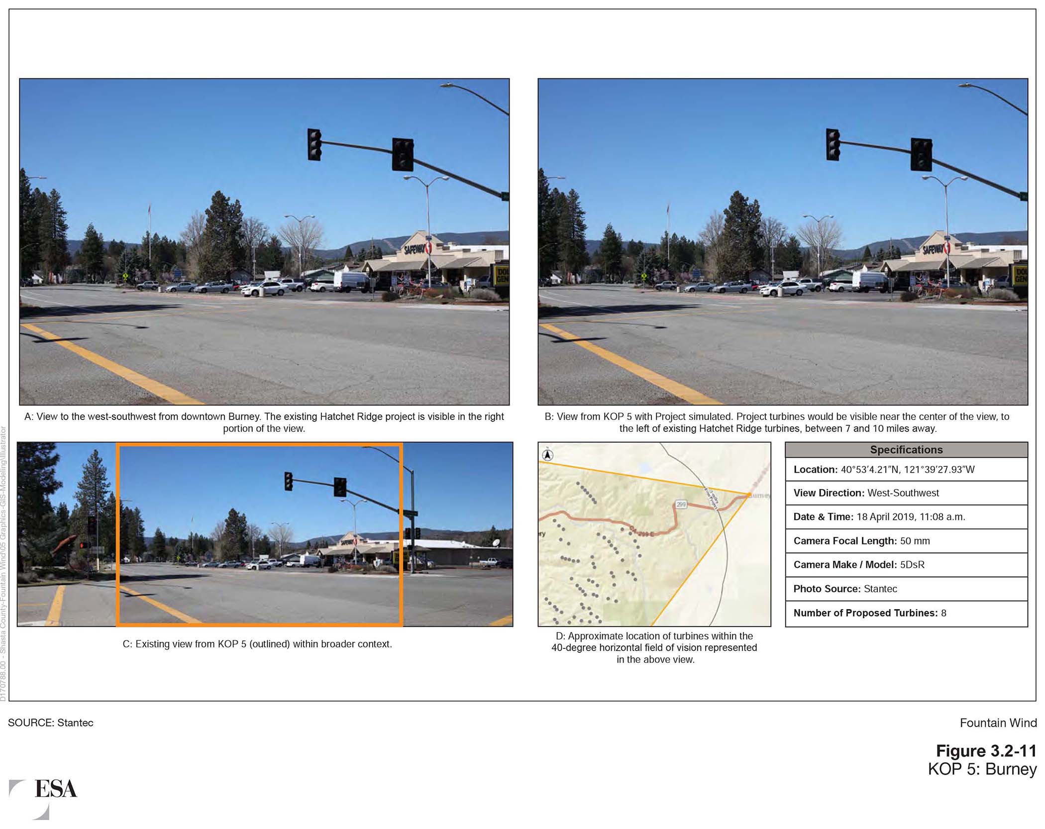
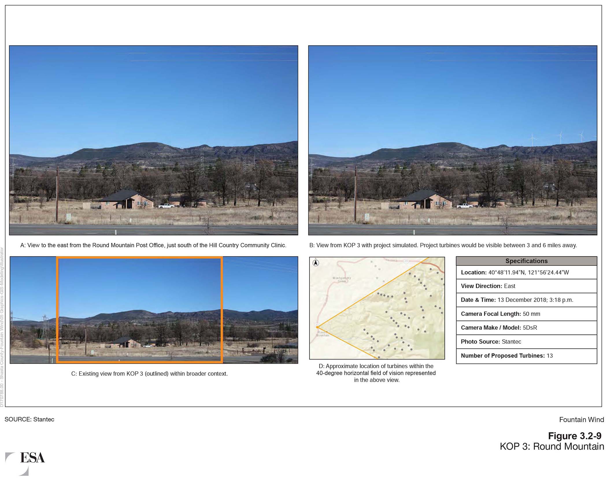
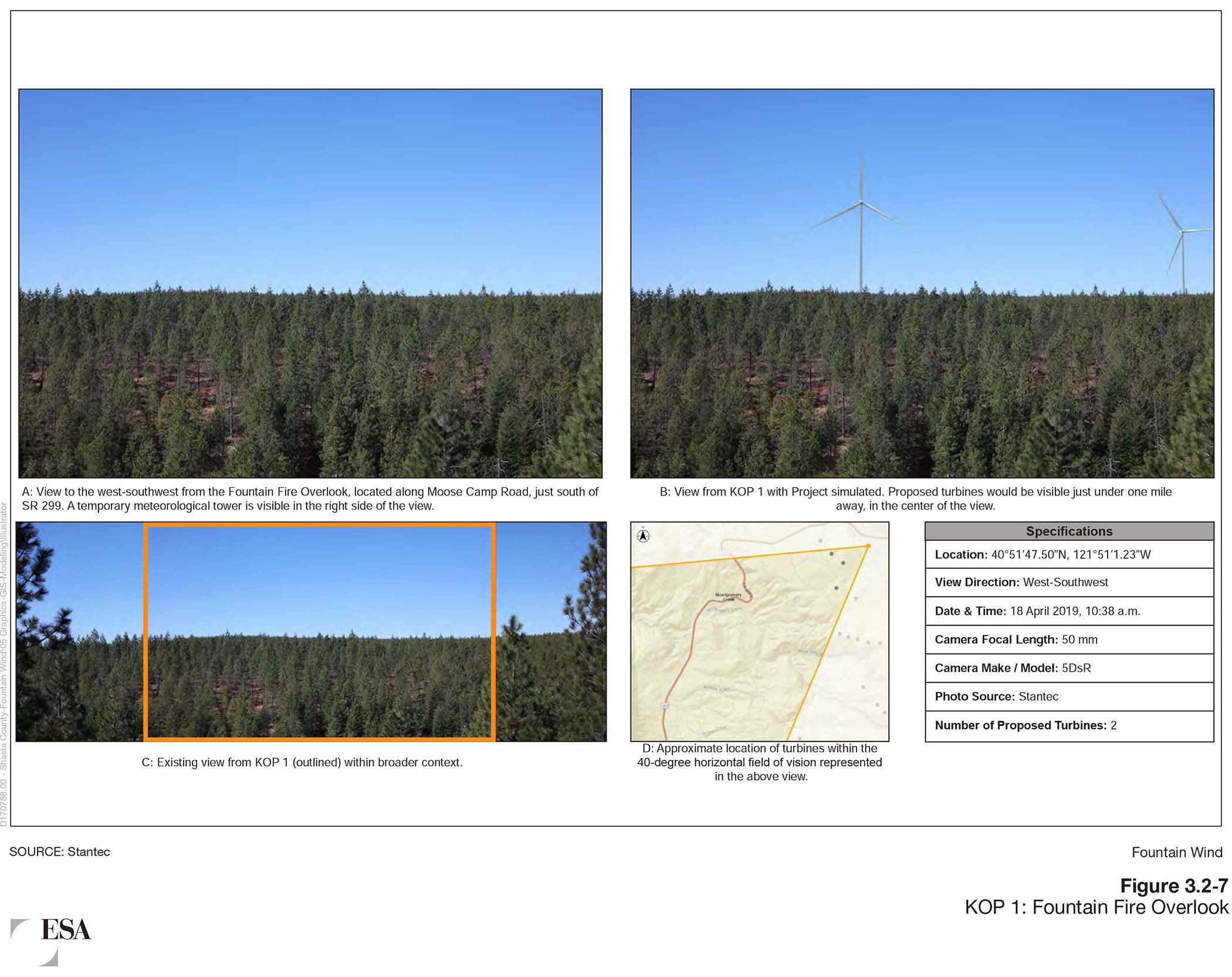
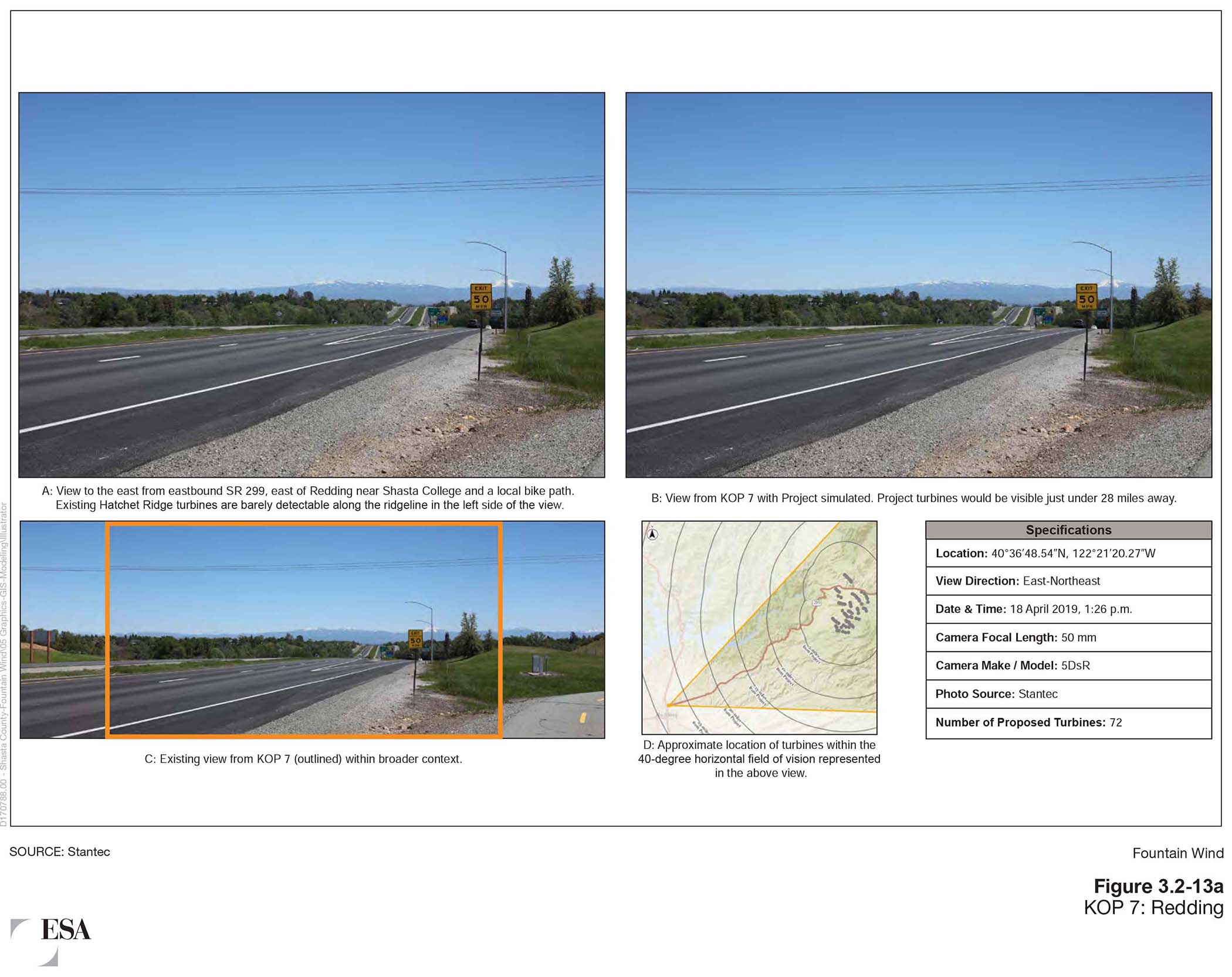
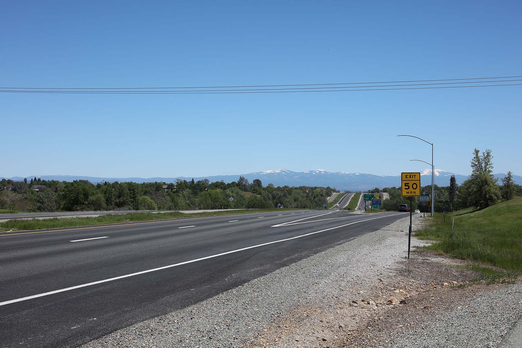
As part of the draft Environmental Impact Report (EIR) that was prepared for the Fountain Wind Project, visual simulations were developed to provide a photographic representation of what the project may look like.
Visual simulations were developed for several Key Observation Points (KOPs) in and around the project area and were performed for all of the originally proposed 72 turbine sites, using the largest turbine configuration considered in the draft EIR: a 5.7 to 7.2 MW turbine with a hub height of 125 meters and rotor diameter of 162 meters.
The photos used for the simulations were captured between December of 2018 and April of 2019. See below for before and after pictures from four KOPs, including; Redding, downtown Burney, the Round Mountain Post Office, and the Fountain Fire Overlook on Moose Camp Road.
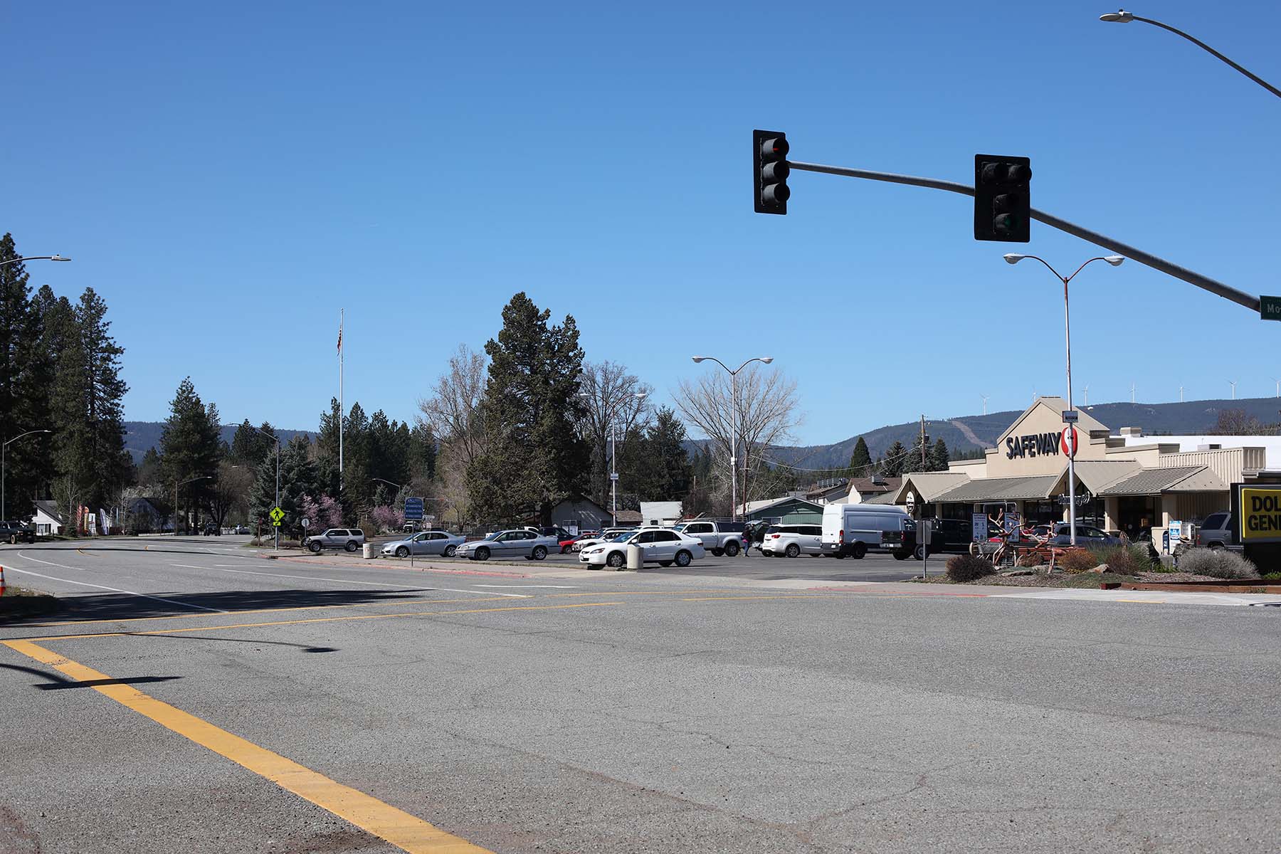
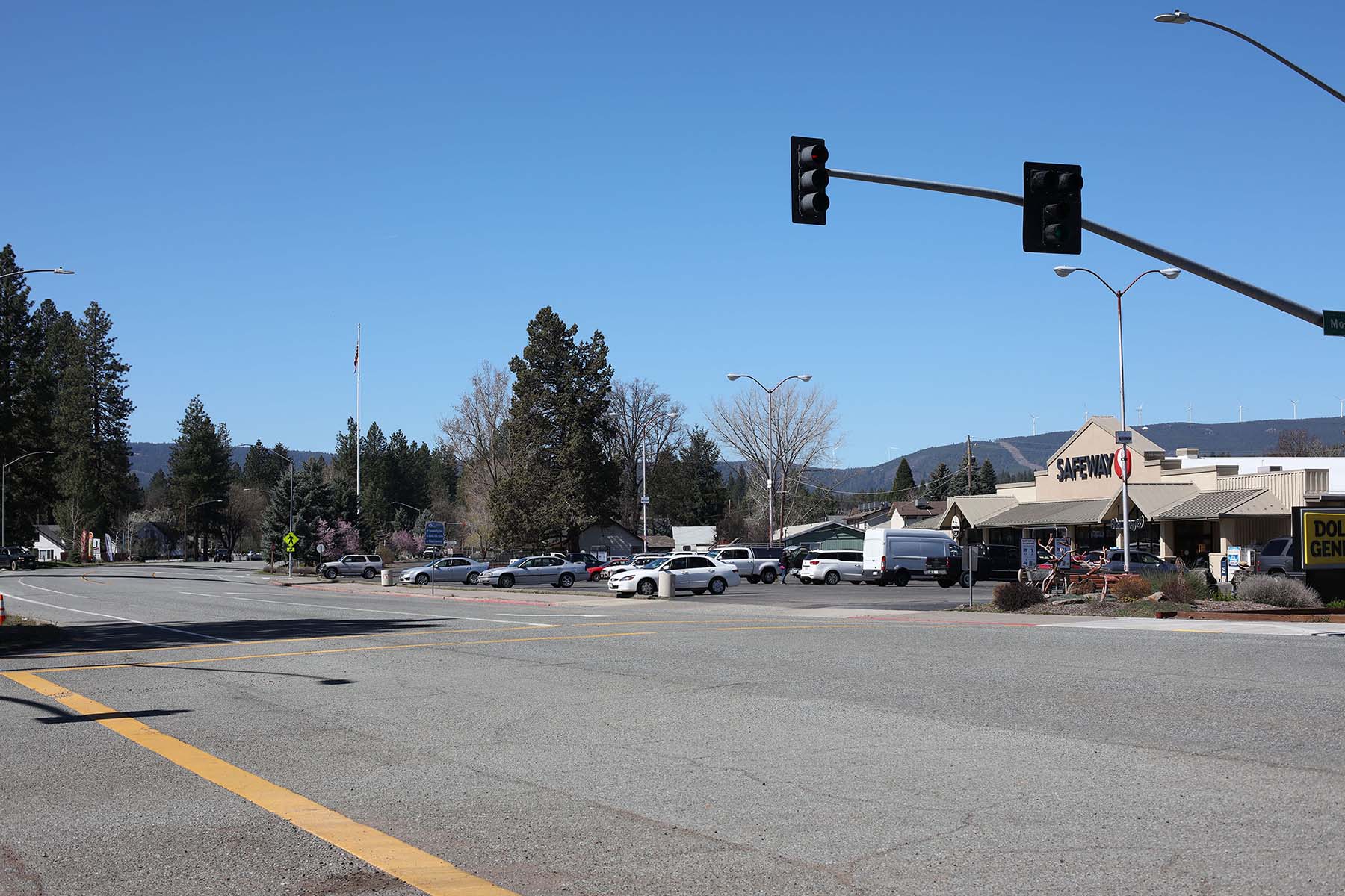
Downtown Burney
Overview
Existing
Proposed
Round Mountain Post Office
Overview
Existing
Proposed
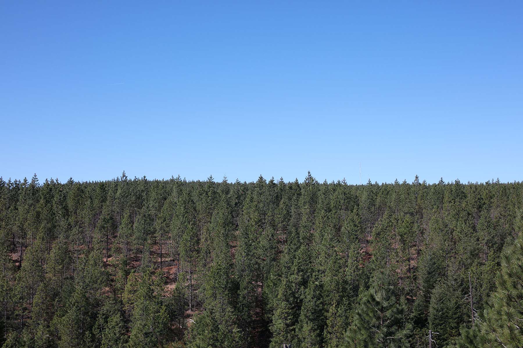
Fountain Fire Overlook (Moose Camp Road, South of SR299)
Overview
Existing
Proposed
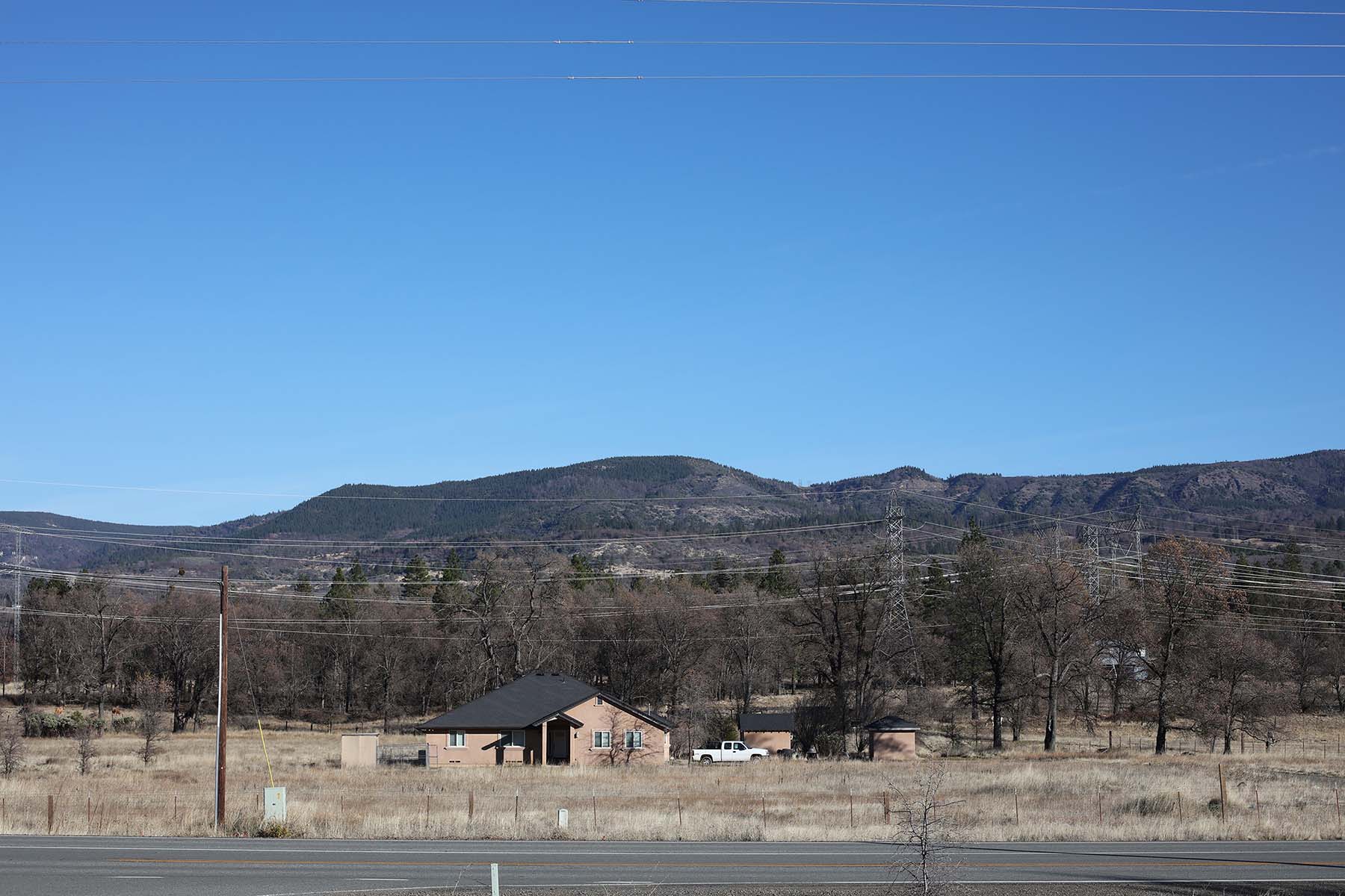
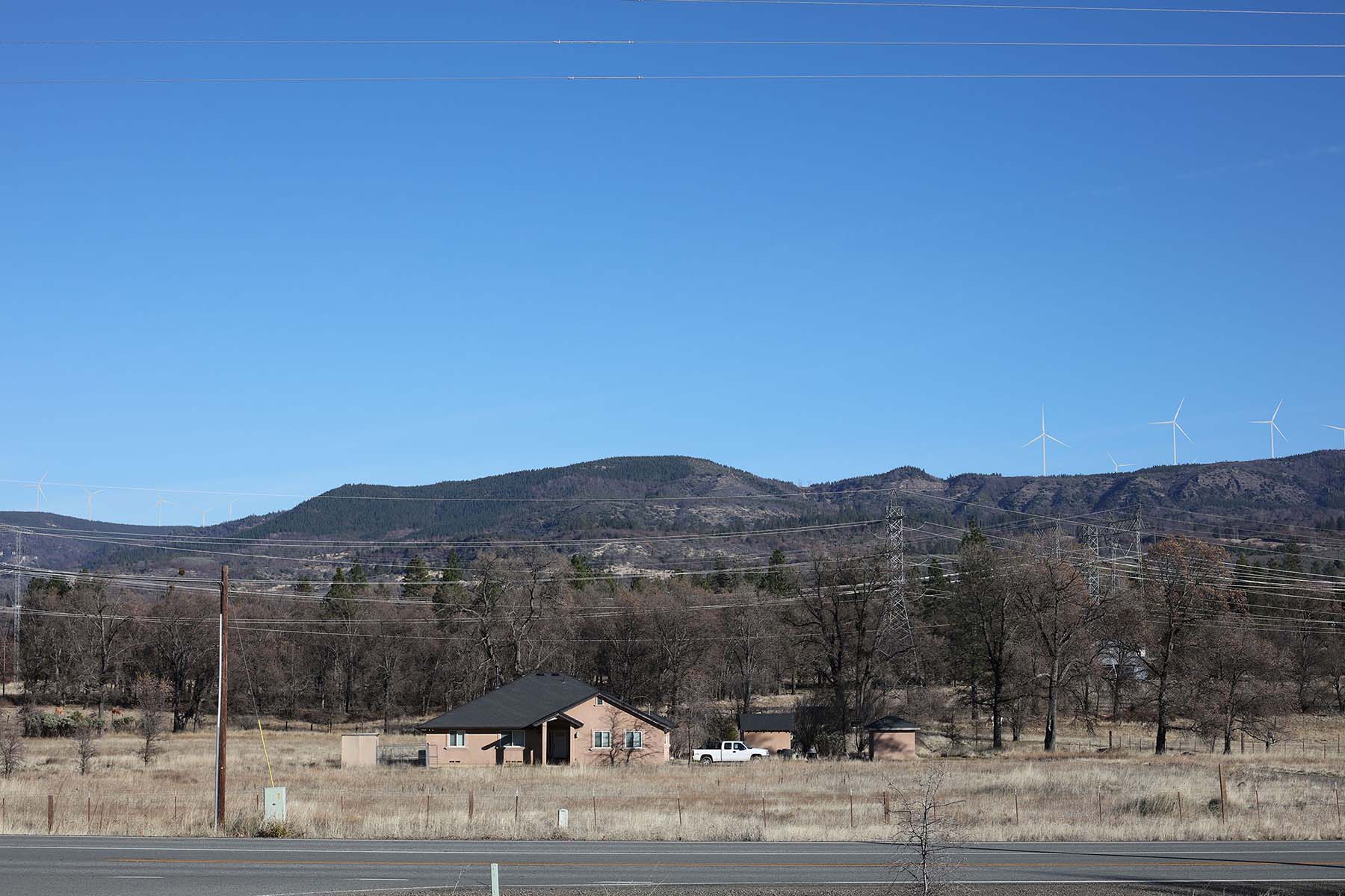
SR 299 in Redding
Overview
Existing
Proposed
In support of the Fountain Wind Project and the benefits it will bring to Shasta County?